(国家自然科学基金 面上项目:联合GNSS和卫星重力研究地下水对华北平原地表形变与水储量变化的影响)
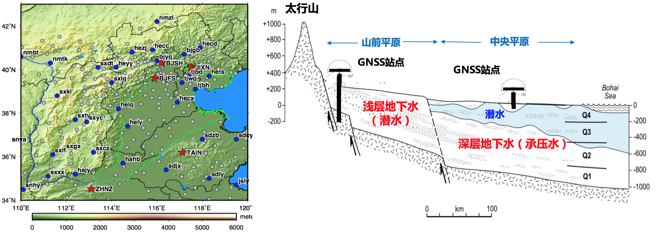
华北平原地下水超采是国内外长期关注的热点研究问题。本项目旨在利用GNSS与卫星重力 两种现代大地测量观测手段,评估地下水对华北平原地表形变与区域水储量变化的影响。本项 目计划基于弹性负荷理论和土壤固结理论分析不同含水层的地下水变化对GNSS站点的负荷形变 非负荷形变的影响。针对浅层含水层,利用GRACE卫星重力观测、潜水井实测和地球物理模 型,分析地下水对地表的负荷形变;针对深层含水层,利用承压水井资料和孔弹性理论,分析 地下水对地表的非负荷形变。此外,基于卫星重力观测手段和水文模式数据,研究华北平原地 下水储量变化的时空分布和趋势。结合水井实测资料和GNSS站点的垂直形变资料估计浅层地下水和深层地下水的储量变化,并据此给出卫星重力估计华北地下水储量变化精度的外部独立检 核。该项研究的开展可为我国实施华北地区水资源管理和制定相关法律政策提供科学依据。
Groundwater depletion in the North China Plain (NCP) is one of the “hot spots” at home and abroad. This project aims at using two modern geodetic observations, i.e., GNSS and satellite gravimetry, to estimate groundwater’s effects on surface deformation and water storage variations in the NCP. Based on elastic loading theory and poroelastic theory, the effects of groundwater in different aquifers on loading deformation and non-loading deformation at GNSS stations will be estimated. For unconfined shallow aquifers, the loading deformation caused by groundwater will be estimated from GRACE, unconfined phreatic water level observations, and geophysical models. For confined deep aquifers, the groundwater-caused poroelastic deformation will be estimated by confined water level observations according to the soil consolidation theory. In addition, we plan to use GRACE satellite gravity observations and land surface models for estimating spatial-temporal variability of groundwater storage (GWS) variations in the NCP. GWS in shallow and deep aquifers will be estimated based on groundwater level observations from monitoring wells and land subsidence measurements from GNSS respectively, which will be used to validate GRACE estimates. This work has great potential to provide a scientific basis for the water resources management and the development of relevant laws and policies to ease the water shortage in the NCP in future.